Mapping Trat - Before and after
When I first posted pictures of my mapping efforts for OpenStreetMap in this blog, I noted that it is kinda pointless to show those maps without a before-after view. But then again, you need to take screenshots of that before because the map does not have a powerful history function. This time, I didn’t forget doing that. So here we are (click the image for a full-sized version):

Trat and around.
On this zoom level, the changes one can see are all almost exclusively traced from Bing satellite imagery. So to improve the map on this zoom level, no GPS is needed and there is no reason to actually be there. A map based on satellite imagery is a good basis for putting in more detail:
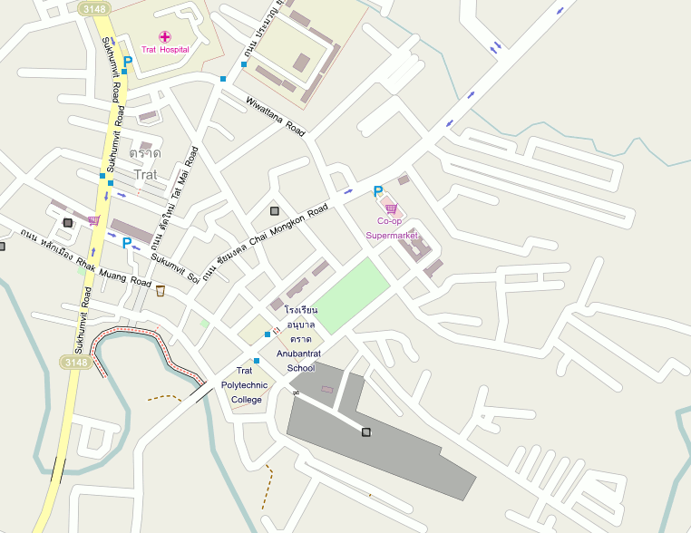
The town
Detail like, most importantly (in my opinion) street names and larger areas which can’t be derived from the satellite imagery alone.
If a city is already mapped from satellite imagery on the above zoom level, it makes future GPS surveys much more effective because the surveyor can for example just walk down the main street and note down the names of the side-streets from the signs instead of having to walk up every alley to trace where it is leading or to see the extend of an area.
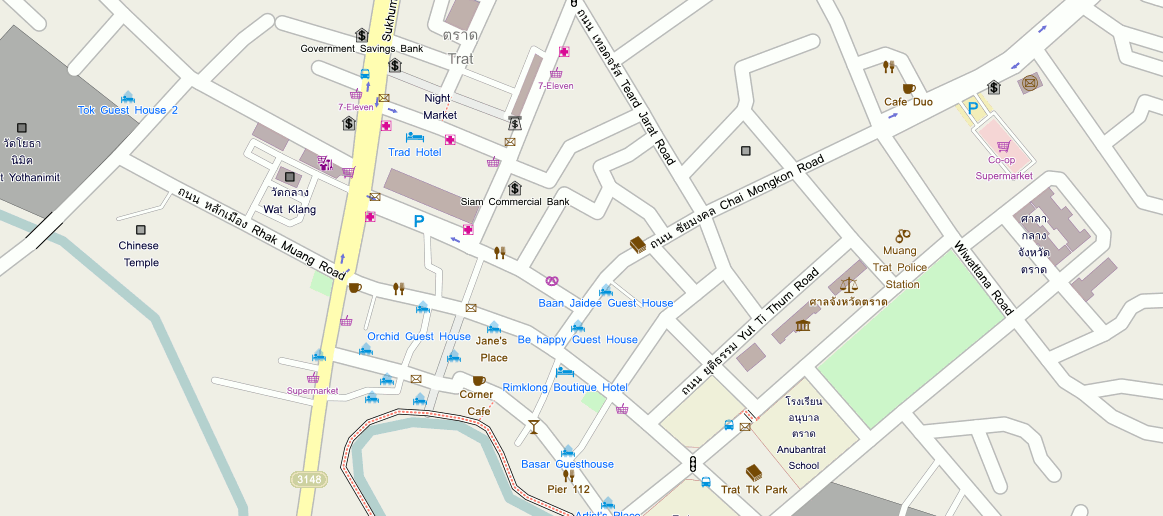
City center
On OpenStreetMap, one can map almost everything. It is possible to map every shop, it is possible to map every building with housenumbers, storeys, type of roof, under construction or not, what type of building etc. etc.
Why?
Because everyone decides for himself what he deems important and what not. Also, the data on OpenStreetMap can be used for quite some different purposes, not only for GPS navigation. Perhaps the name is misleading, it should be called OpenWorldMap. And unlike in the Wikipedia, there are no “relevancy discussions”.
For example there is a project that strives to add the necessary information to the database to display the map in 3D.
So when surveying, I restrict myself to note down certain points of interests that I deem relevant for myself. Most importantly, street names, but also: banks, atms, post offices and boxes, pharmacies, supermarkets, guest houses, restaurants, bars and cafes, bus stands and stops, temples, schools, hospitals, marketplaces, public buildings and the like.
So, how complete is the map in your neighborhood?
